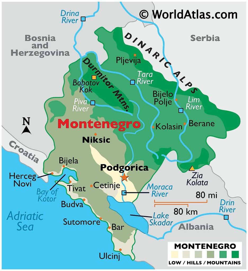
Montenegro is divided into 24 municipalities (opstine, sing. opstina). In alphabetical order, the municipalities are: Andrijevica, Bar, Berane, Bijelo Polje, Budva, Cetinje (Old Royal Capital), Danilovgrad, Gusinje, Herceg-Novi, Kolasin, Kotor, Mojkovac, Niksic, Petnjica, Plav, Pljevlja, Pluzine, Podgorica Capital City, Rozaje, Savnik, Tivat, Tuzi, Ulcinj and Zabljak. The Podgorica capital city is further divided into 1 subdivision called Golubovci City municipality.
Located in central Montenegro, Podgorica is the Capital and the largest city of Montenegro. It serves as the cultural, administrative and economic center of the country. The city of Cetinje (designated as Prijestonica) is the former Royal Capital of Montenegro.
Where is Montenegro?
Montenegro is a small mountainous country located in South Eastern Europe on the Balkan Peninsula. It is positioned in the Northern and Eastern hemispheres of the Earth. Montenegro has a coast on the Adriatic Sea to the south. It is bordered by 5 countries: by Croatia in the southwest; Bosnia and Herzegovina in the northwest; Serbia in the northeast; Kosovo in the east and Albania in the southeast.
Montenegro Bordering Countries:
Albania, Serbia, Croatia, Bosnia And Herzegovina.
Regional Maps: Map of Europe
Outline Map of Montenegro
Key Facts
Legal Name
Montenegro
Flag
Capital City
Podgorica; note – Cetinje retains the status of “Old Royal Capital”
42 26 N, 19 16 E
Total Area
13,812.00 km2
Land Area
13,452.00 km2
Water Area
360.00 km2
Population
622,137
Currency
Euros (EUR)
GDP
$5.49 Billion
GDP Per Capita
$8,832.04
This page was last updated on February 25, 2021
Source link : https://www.worldatlas.com/maps/montenegro
Author :
Publish date : 2021-02-25 08:00:00
Copyright for syndicated content belongs to the linked Source.
