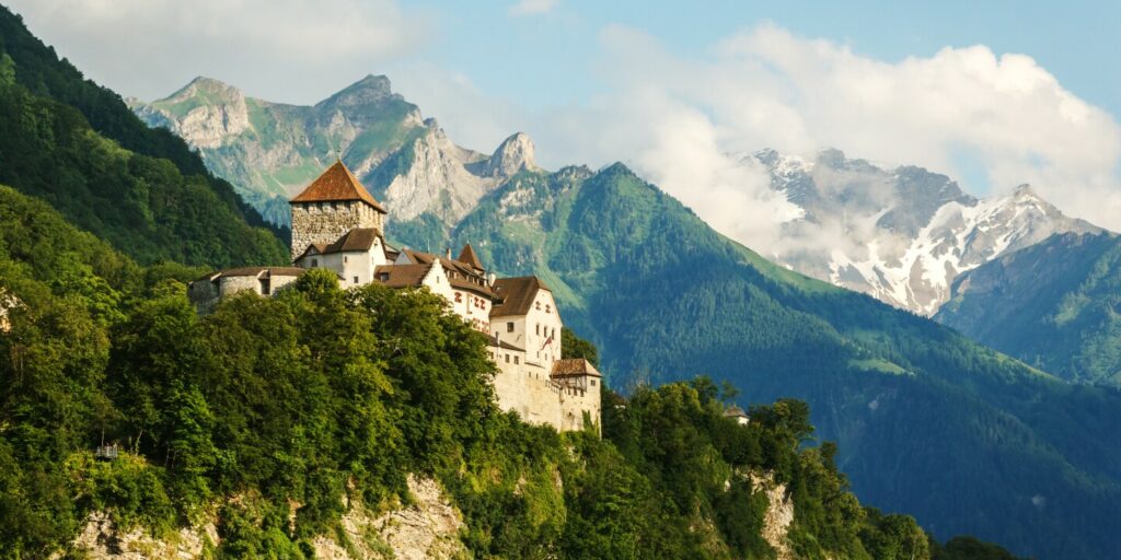
Bordered by Switzerland and Austria, Liechtenstein is a mountainous country. Its tallest mountain is Grauspitz, which has an elevation of 8,527 feet.
Photo by Mario Krpan/Shutterstock
It was in Planken that I experienced the most spectacular views of the entire trail. The sky was a wispy, milky blue, and the valley with its tidy fields ran lush and green to the river and the Swiss Alps on the other side. But days of rain had turned twisting, precipitous trails into muddy flumes, and washed away the flat rocks by which hikers could cross several cascading streams. In a few places where the slope dropped sharply to one side of the path, rope was stretched between trees to provide a handhold—but the ground was smeared out and more than once I found myself flailing wildly for the rope when my feet flew out beneath me. At 23 I would have found this thrilling. I would have laughed as I plunged shin-deep into a treacherous stream and taken pride in the layer of mud that streaked my clothes and face, the twigs caught in my hair, when I arrived in Nendeln 90 minutes later. At 53, I was just happy to have completed the descent without injury and grateful for the hot shower in my hotel room.
Then, too, there was the beer.
Two years ago, responding to the growing popularity of e-bikes, Knöpfler and his team began developing an alternate, bike-friendly route, which necessitated new signage along the trail and a rebuild of the LIstory app. The new route makes the trail more accessible to older or less-fit hikers and to those with less time for the trek. “But I think you have a deeper experience when you do it on foot,” Knöpfler confided to me.
With over 20 miles left to cover, I didn’t think I’d be able to finish in time, so on my last morning I rented an e-bike in the village of Eschen and zoomed back out into the countryside. The skies were still gloomy but the air was warming, and the ease with which I mounted the rolling hills of Güediga, where the medieval Counts of Vaduz had their gallows, was exhilarating. But I’d found a rhythm over those first two long days of walking, and as I pedaled through the villages of Bendern and Ruggell and out through the peat bogs and waving purple moor grass of the Ruggeller Riet, I missed the amble through the countryside, the ability to see things from far off and have time to really think about them before I passed. I had to remind myself to slow down, to make frequent stops, so as to fully experience what I was seeing.
Liechtensteiners refer to the northern part of the country as the Unterland, for its relative flatness. Long trail sections on the banks of the Rhine and, to the east, along the base of Schellenberg Hill, benefit from this easier terrain, and I powered down the e-bike to enjoy the mild breeze and the abundant flowers. But when the long climb toward the Upper Castle began, rising almost 900 feet in 2.5 miles, I cycled up to turbo mode, covering in 20 minutes what would have taken an arduous 90 minutes on foot.
The Upper Castle, built in the 13th century by the Lords of Schellenberg, is the indisputable highlight of this final segment, a jagged ruin spread across a craggy hilltop with views of the valley and of Austria to the north. It’s easily accessed by car, and when I finally arrived, a family was picnicking near the entrance, a handful of tourists wandering the castle’s inner wards taking selfies—more people than I’d seen in three days. I was tempted to feel grouchy, proprietary, having grown accustomed to the solitude. But the weather had suddenly turned beautiful, a sheet of pastry-puff clouds slanting over the valley, so I sat on an 800-year-old stone wall, munched my last energy bar, and turned off the app.
Liechtenstein is one of the least-visited countries in the world, according to the United Nations World Tourism Organization. Fewer than 80,000 people a year make the trip, and now I was one of them. I’d covered virtually the whole country, from south to north, stopped at 147 points of interest (most of them, anyway), braved downpours and mudslides and glitchy apps to get to this medieval fortress in Europe’s secret heart. I was actually pleased that the trek hadn’t gone too smoothly—the mishaps forced me to fall back on my instincts, make some mistakes, do things how I had in my 20s, before GPS and smart phones. I’d proved something to myself, and though I was looking forward to getting home and seeing my family, part of me was eager to find the next trail.
But the day was getting late, the last fog glittering as it pulled slowly off the mountainside. I had one more descent to make, five miles left to cover, so when the wind picked up and the sun slid behind a cloud, I hopped on the e-bike and set out on a harrowing ride down to Mauren, then an easy sprint to Schaanwald, to the nearly deserted border post where the trail, and the country, end.
Source link : https://www.afar.com/magazine/what-it-was-like-to-walk-across-liechtenstein
Author :
Publish date : 2023-07-13 07:00:00
Copyright for syndicated content belongs to the linked Source.
